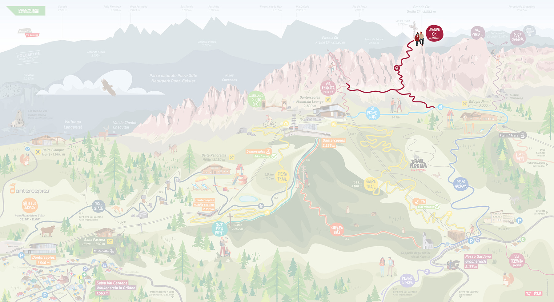
Scenic walks in the beautiful Dantercepies area
Explore the untouched nature in Val Gardena on our many summer walks.
The lifts are open daily from 08.30 to 16.30
The Dantercepies area offers numerous scenic walks, many suitable for families, through the unspoilt landscape.

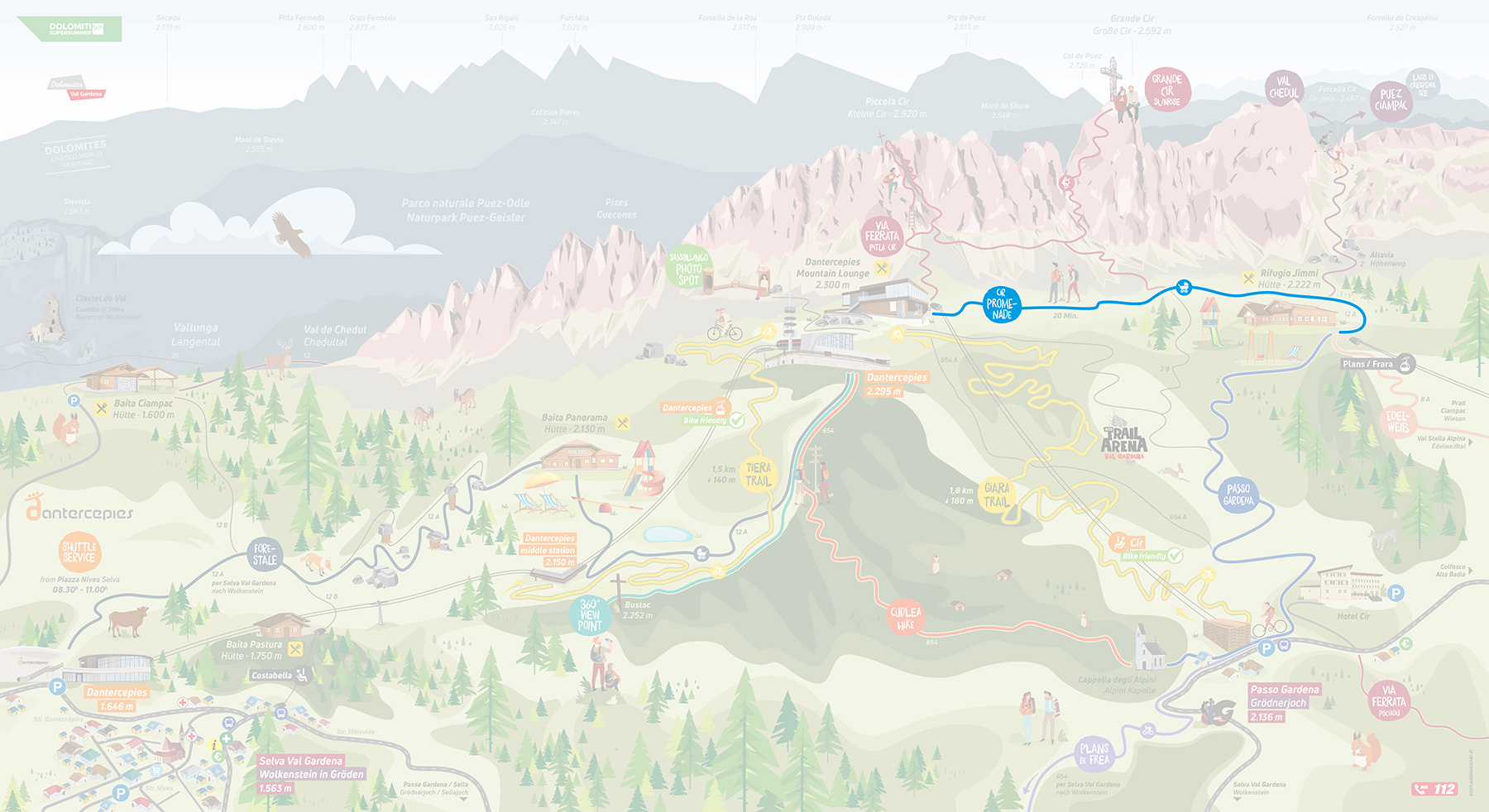
An easy walk that is also suitable for pushchairs up to the Jimmy hut, returning on the same path. A spectacular route between the Cir Group and Sella that’s accessible to all.
Start: Dantercepies mountain station (2300 m)
Finish: Dantercepies mountain station (2300 m)
Height difference: ascent 80 m - descent 80 m
Length: 1.5 km
Highest point: 2300 m
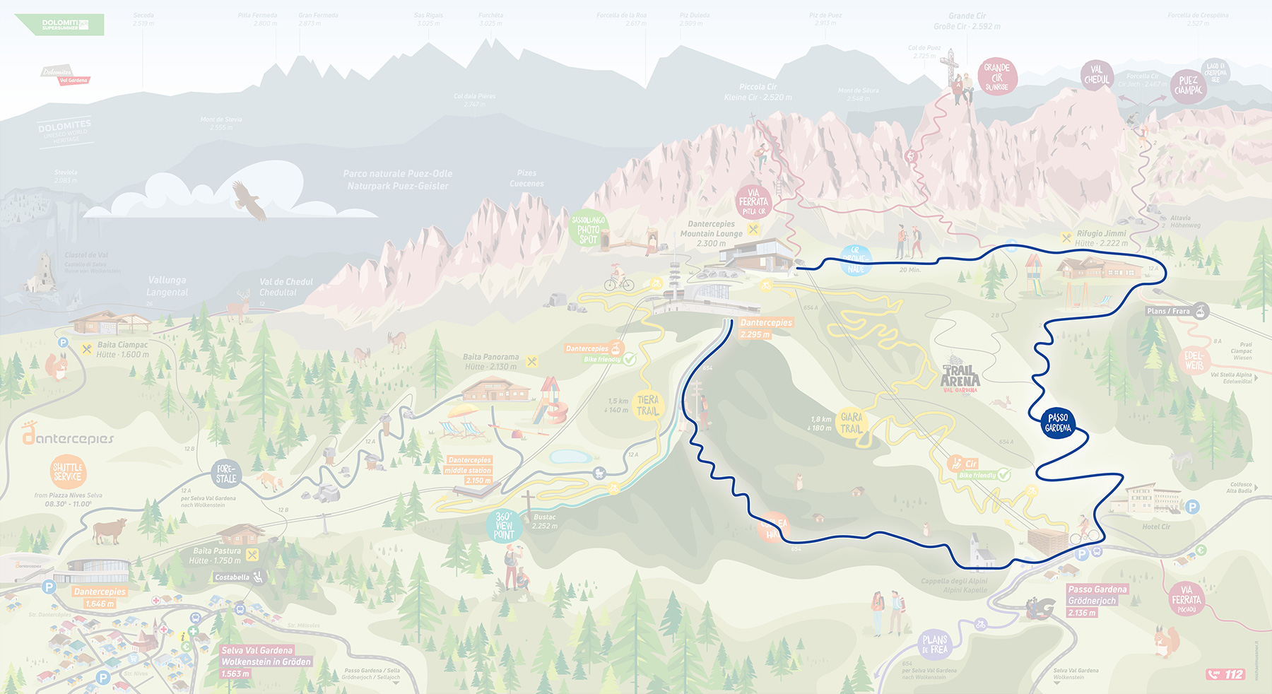
An easy walk across mown meadows and past old haylofts to the Gardena Pass. Return to the starting point via the Cir chairlift. Alternatively, you can go down on the Cir chairlift and walk up on foot.
Start: Dantercepies mountain station (2300 m)
Finish: Dantercepies mountain station (2300 m)
Height difference: ascent 0 m - descent 160 m
Length: 2 km
Highest point: 2300 m
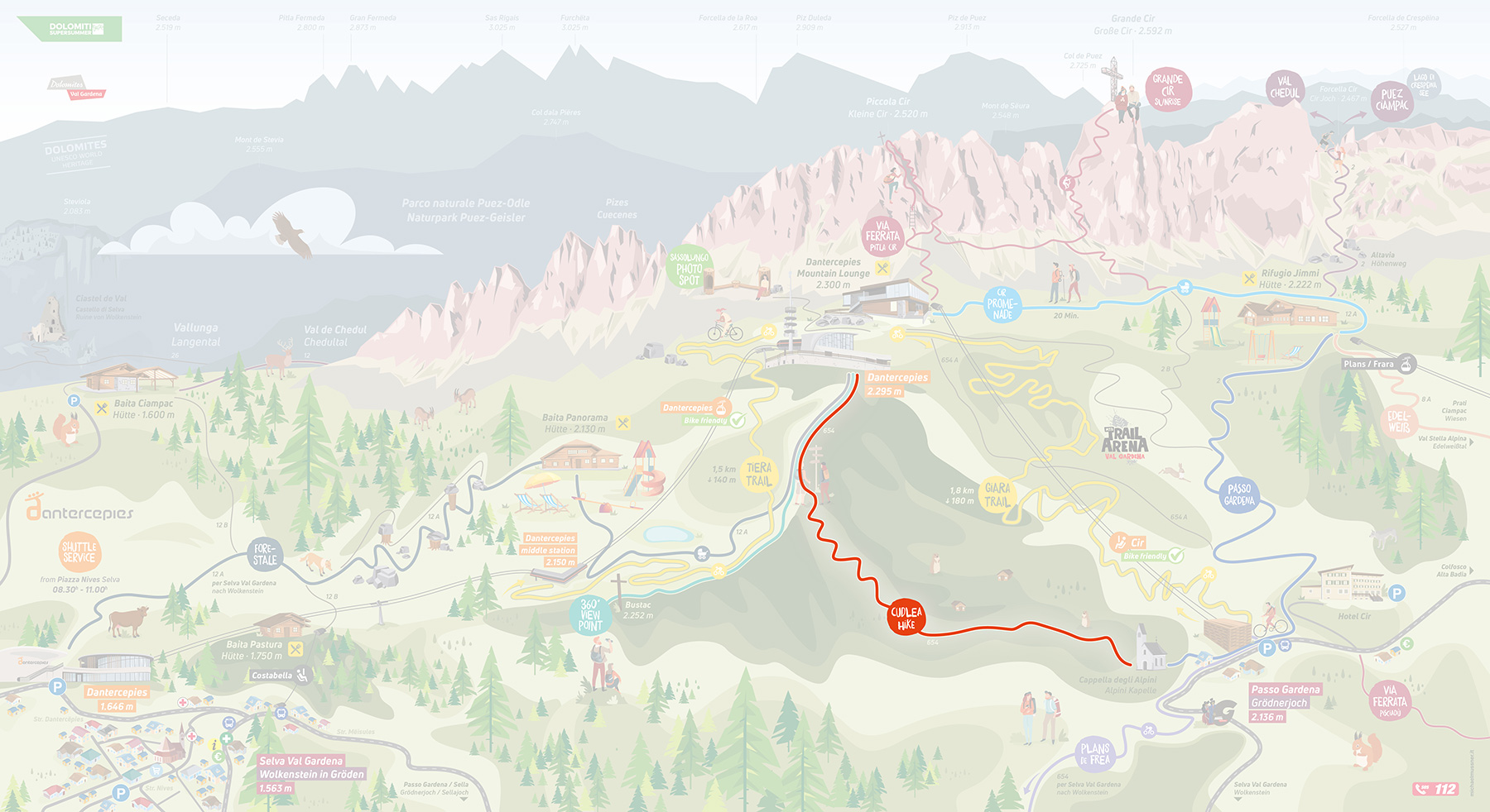
An easy walk with great views across flower-filled meadows in the splendid setting of the Gardena Pass. Walk past the Jimmy hut, Gardena Pass and Cudlea. From the Gardena Pass, there’s the option of reducing the length of the walk with a ride on the Cir chairlift.
Start: Dantercepies mountain station (2300 m)
Finish: Dantercepies mountain station (2300 m)
Height difference: ascent 160 m - descent 160 m
Length: 4 km
Highest point: 2300 m
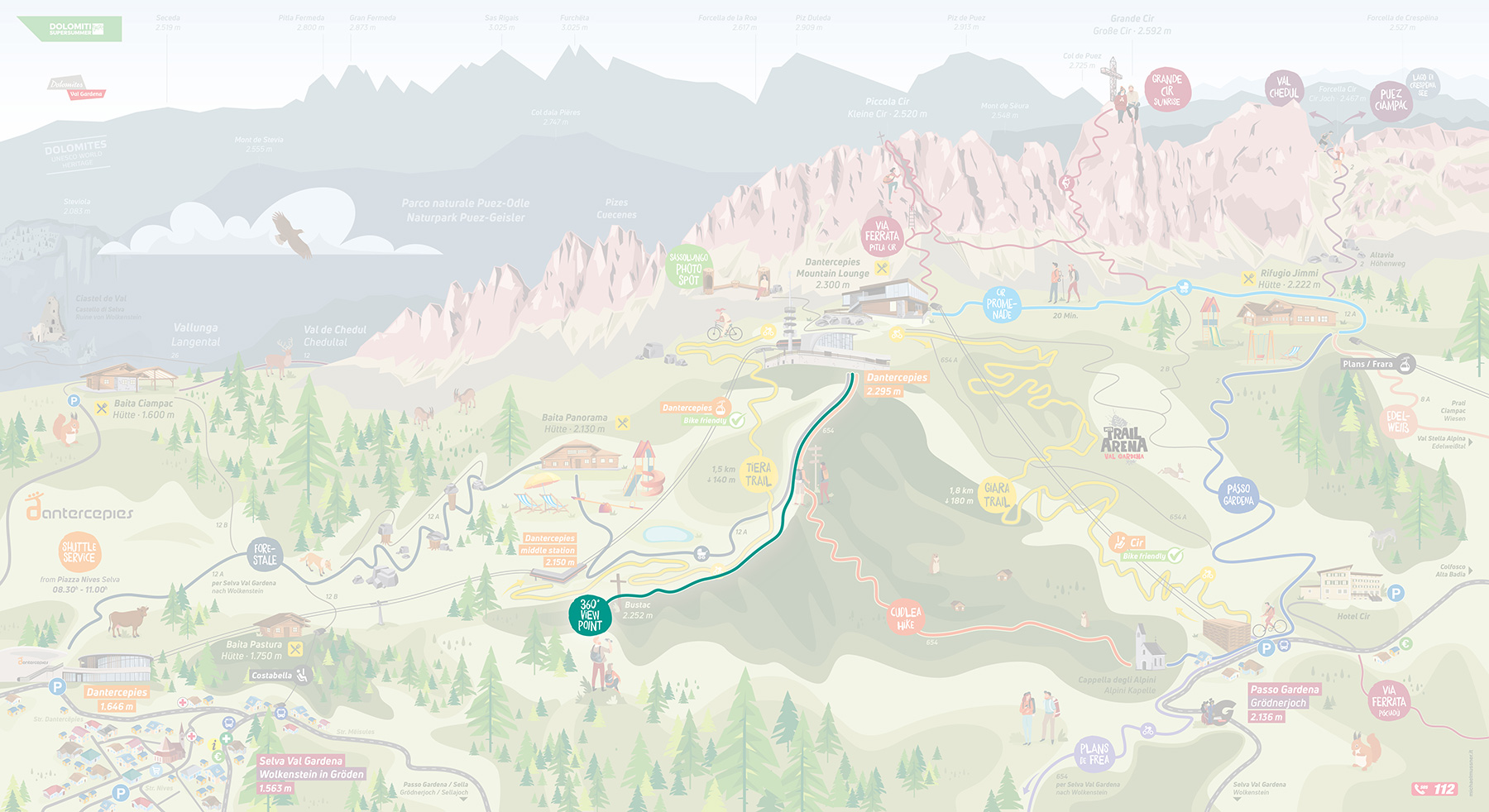
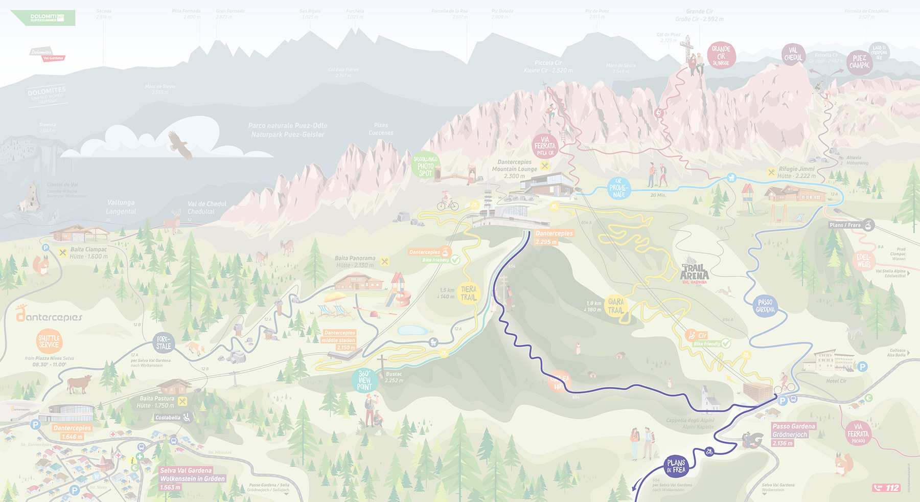
Stunning walk to the expansive grassy peak of Bustac Hill (2250 m), famous for its statue of Christ. Enjoy magnificent views of the Dolomites from this little-visited spot.
Start: Dantercepies mountain station (2300 m)
Finish: Dantercepies middle station (2150 m)
Height difference: ascent 80 m - descent 160 m
Length: 1.5 km
Highest point: 2300 m
Descent to the Gardena Pass across the flower-filled meadows of Plans de Frea at the foot of the Sella massif, where arnica blooms in July. You can avoid the 160 m altitude difference by taking a ride up or down on the Cir chairlift.
Start: Dantercepies mountain station (2300 m)
Finish: Selva di Val Gardena (1600 m)
Height difference: ascent 0 m - descent 700 m
Length: 6.5 km
Highest point: 2300 m
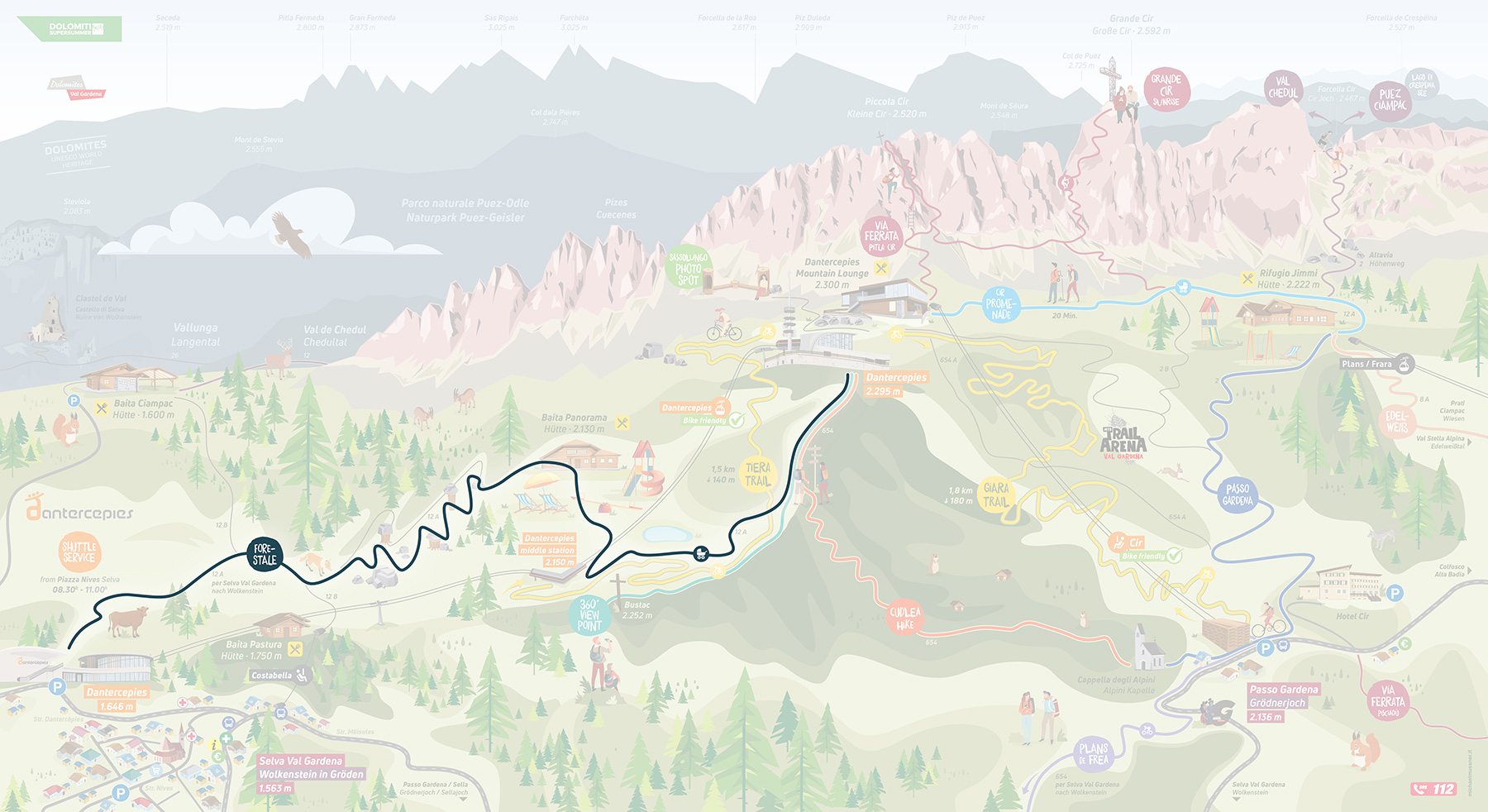
Go down (or up) the Dantercepies valley via a beautiful path and the forest road.
Start: Dantercepies mountain station (2300 m)
Finish: Dantercepies valley (1650 m)
Height difference: ascent 0 m - descent 650 m
Length: 4 km
Highest point: 2300 m
Spectacular itinerary amidst the peaks of the Cir Group within the UNESCO Puez-Odle Nature Park. A very rewarding route along the Alta Via no. 2 trail.
Start: Dantercepies mountain station (2300 m)
Finish: Dantercepies mountain station (2300 m)
Height difference: ascent 300 m - descent 300 m
Length: 4 km
Highest point: Cir Pass (2470 m)
Spectacular trail along the Puez lunar highlands, returning through the Valley. You’ll get as far as the Rifugio Puez in the heart of the UNESCO Puez-Odle Nature Park. Can be undertaken in either direction along the Alta Via no. 2.
Start: Dantercepies mountain station (2300 m)
Finish: Selva - Vallunga (1600 m)
Height difference: ascent 490 m - descent 1120 m
Length: 14.5 km
Highest point: Forcella Crespeina (2530 m)
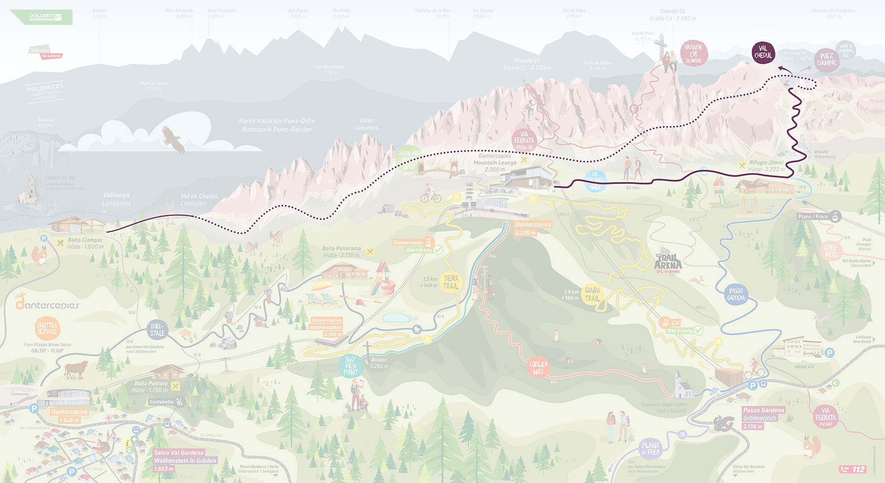
The route descends (or climbs) the Val Chedul, behind the Cir Group. Spectacular, quieter itinerary in the heart of the UNESCO Puez-Odle Nature Park. Can be undertaken in either direction.
Start: Dantercepies mountain station (2300 m)
Finish: Selva - Vallunga (1600 m)
Height difference: ascent 230 m - descent 860 m
Length: 6.5 km
Highest point: Cir Pass (2470 m)
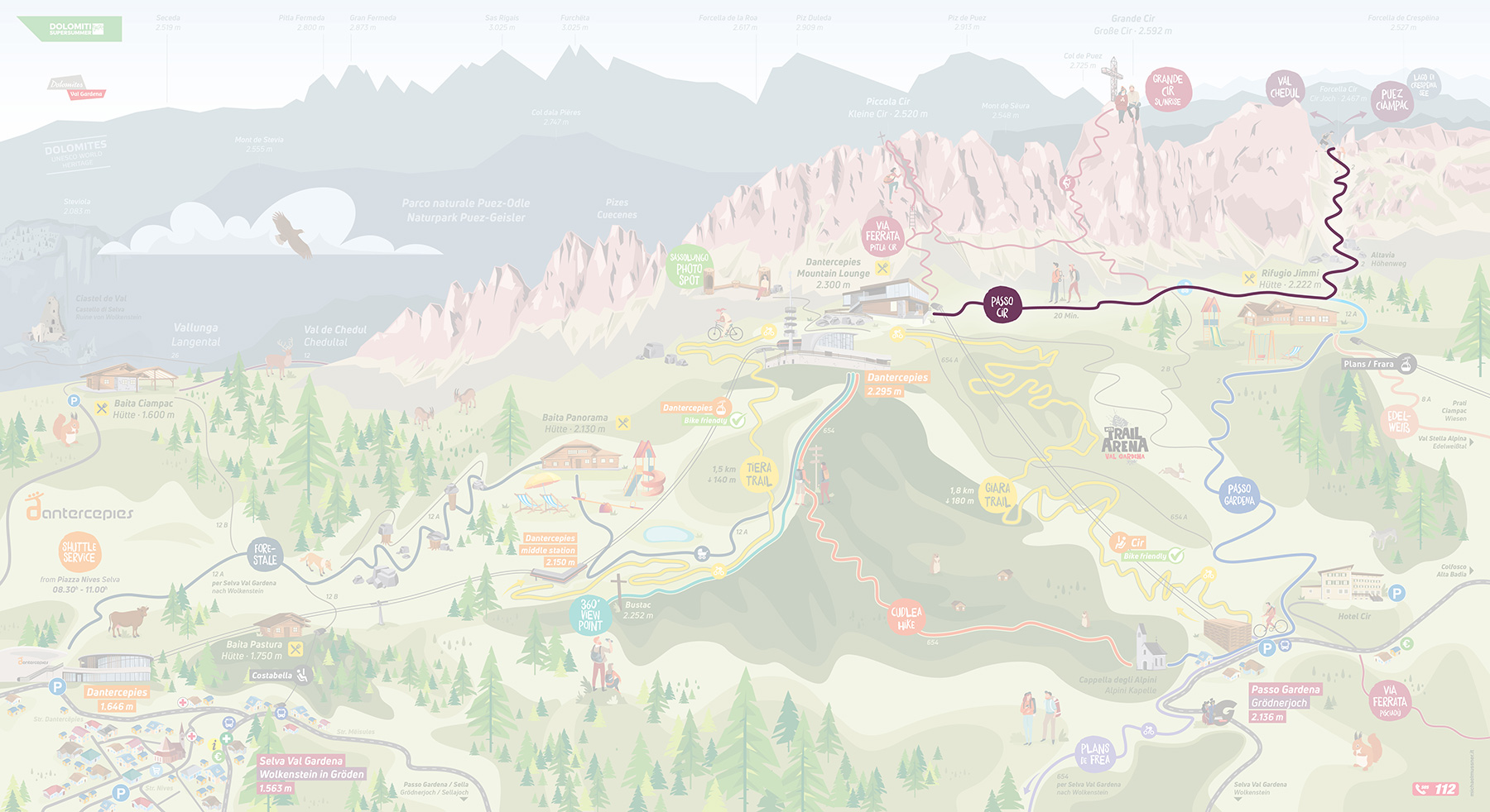
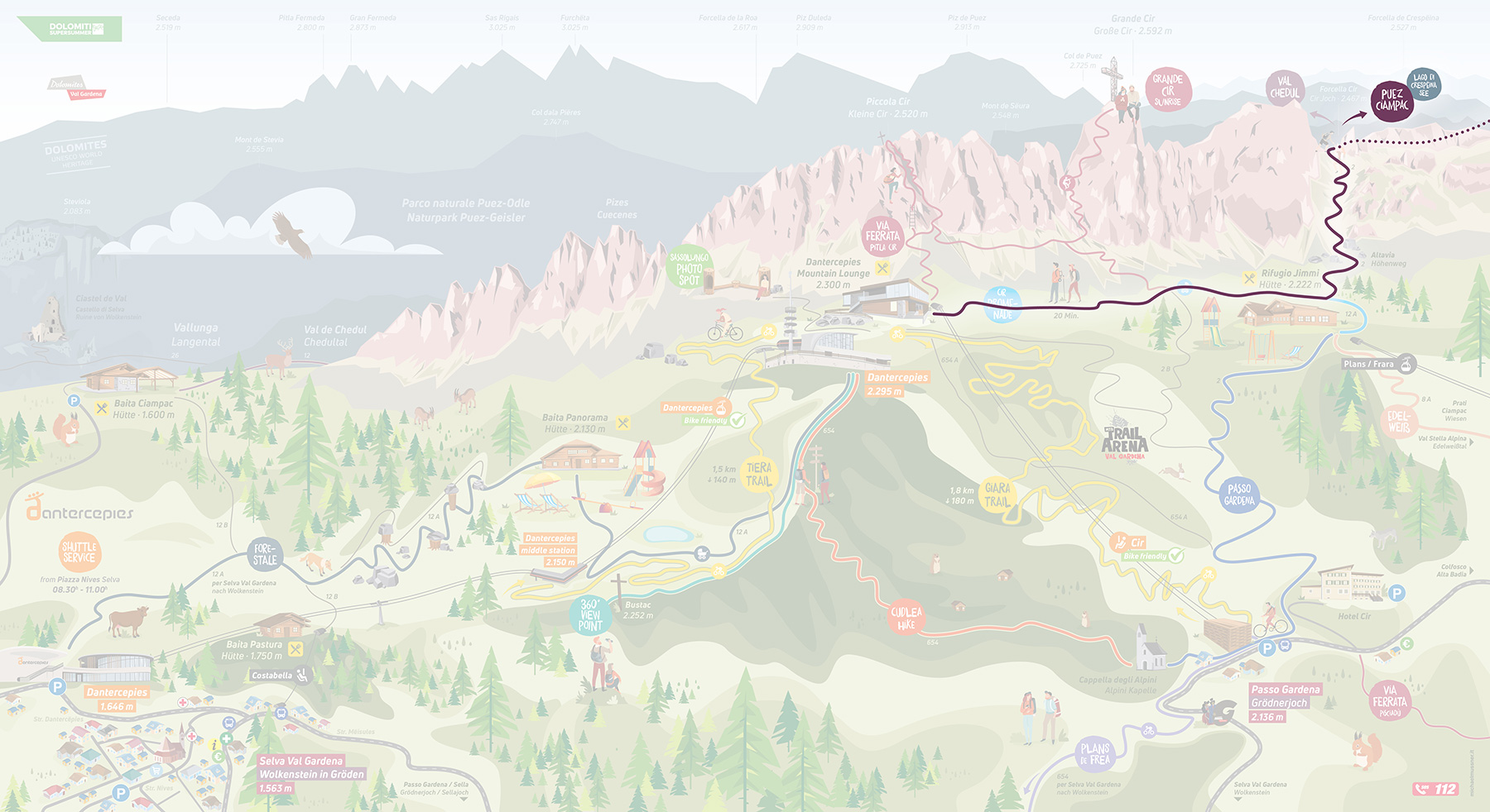
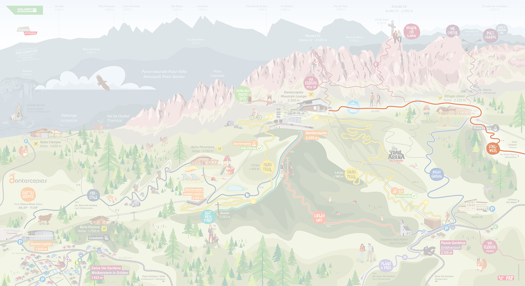
Gorgeous high-altitude itinerary at the foot of the Cir/Ciampac Group, mainly on the Badioto slope. Optional descent to Colfosco/ascent to the Plans-Frara lift.
Start: Dantercepies mountain station (2300 m)
Finish: Dantercepies mountain station (2300 m)
Height difference: ascent 250 m - descent 250 m
Length: 8 km
Highest point: Dantercepies mountain station (2300 m)
A trail that takes you through the Sella Massif, up to the traditional Rifugio Cavazza beside Lake Pisciadù, and along the Alta Via no. 2. From here, several options are available in the Sella Group. Taking the Cir chairlift will eliminate a climb of 160 m. There’s a short, easy via ferrata trail before you reach the Rifugio Cavazza.
Start: Dantercepies mountain station (2300 m)
Finish: Dantercepies mountain station (2300 m)
Height difference: ascent 650 m - descent 650 m (500 m with the Cir chairlift)
Length: 8 km
Highest point: Sella Group (2600 m)
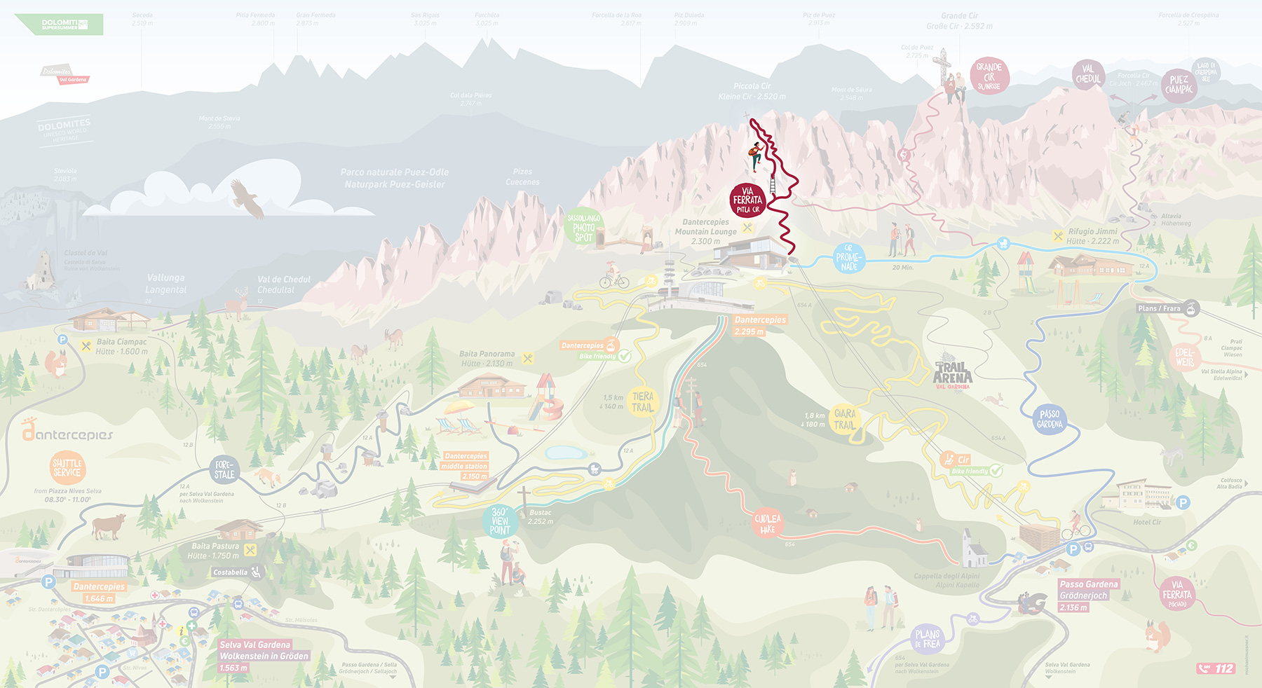
Despite being short, the small Cir via ferrata should not be underestimated and can require an afternoon to complete. After a short period, you reach a wonderful viewpoint looking across the valley and the entire nature park.
Start: Dantercepies mountain station (2300 m)
Finish: Dantercepies mountain station (2300 m)
Height difference: ascent 410 m - descent 4100 m
Length: 3.4 km
Highest point: Pitla Cir (2514)
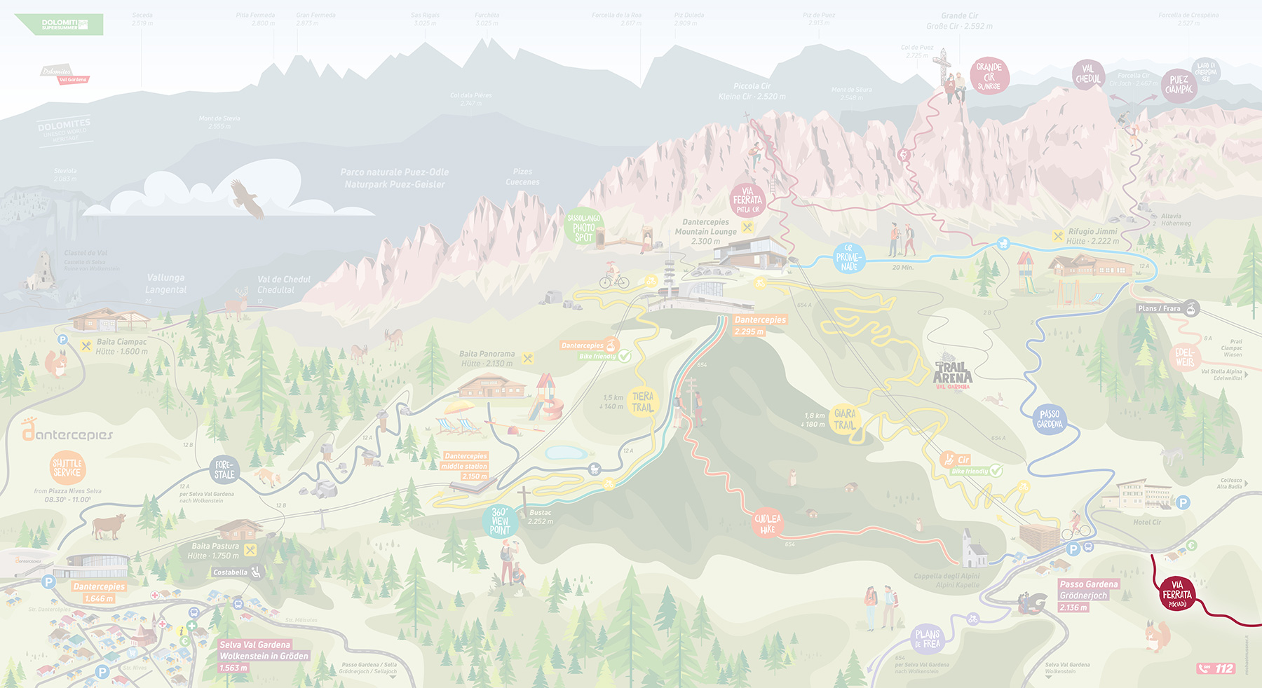
An easy via ferrata that’s ideal for a first attempt. Enchanting views at the top.
Start: Dantercepies mountain station (2300 m)
Finish: Dantercepies mountain station (2300 m)
Height difference: ascent 460 m - descent 460 m
Length: 2.8 km
Highest point: Gran Cir - 2,578 m